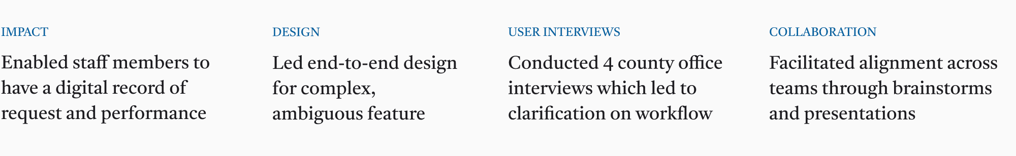
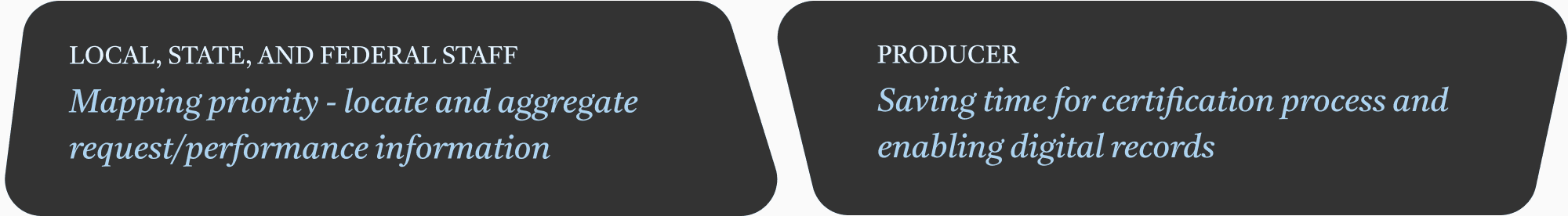
Digitizing Request and Performance
Reducing paper trail - record request and performance activity on map view

Design role
Background
The Conservation Reserve Program (CRP) is a voluntary, federally funded program administered by the U.S. Department of Agriculture (USDA).
It pays agricultural producers to remove environmentally sensitive or highly erodible cropland from agricultural production and replace it with resource-conserving plant life.

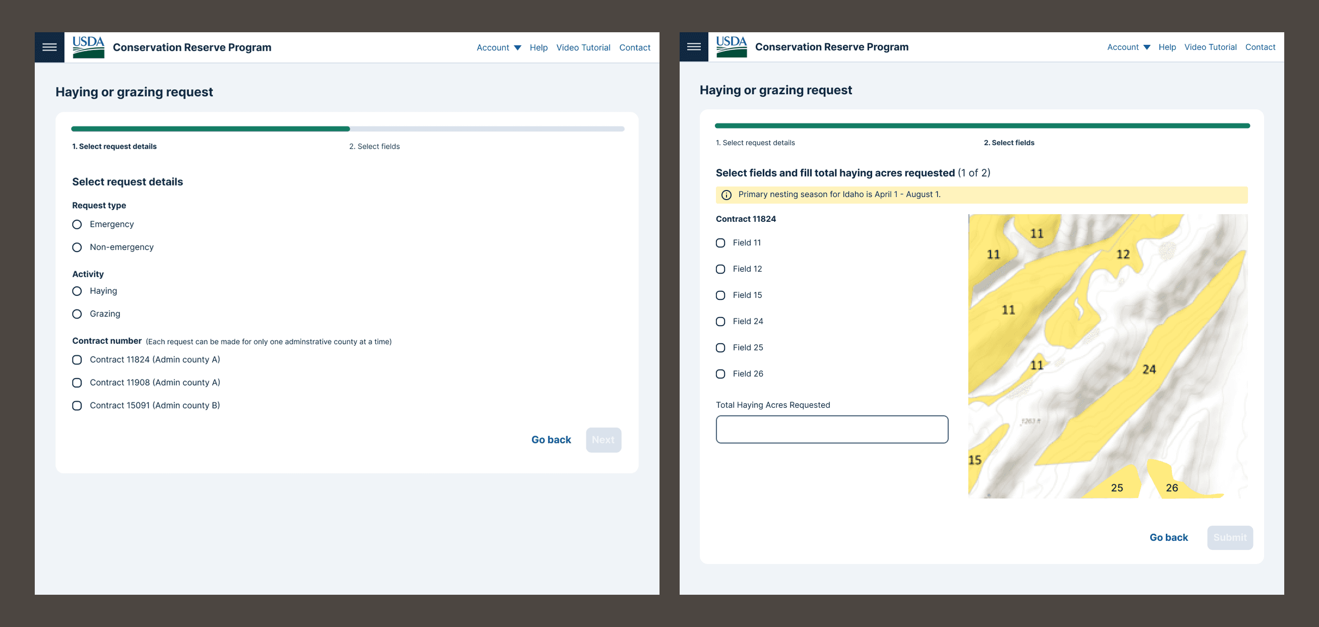
—> In order to hay and graze on contracted lands, producers need to submit a request to their county office.
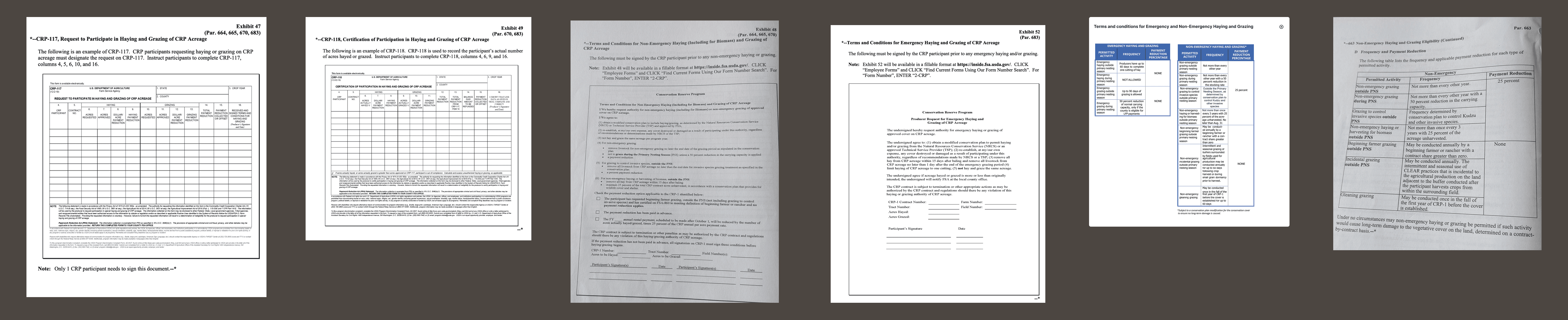
Making sense from current process
Example of paper forms (Exhibit 48, Exhibit 52, CRP-117, CRP-118 ) - producers need to fill out in order to request haying or grazing activity
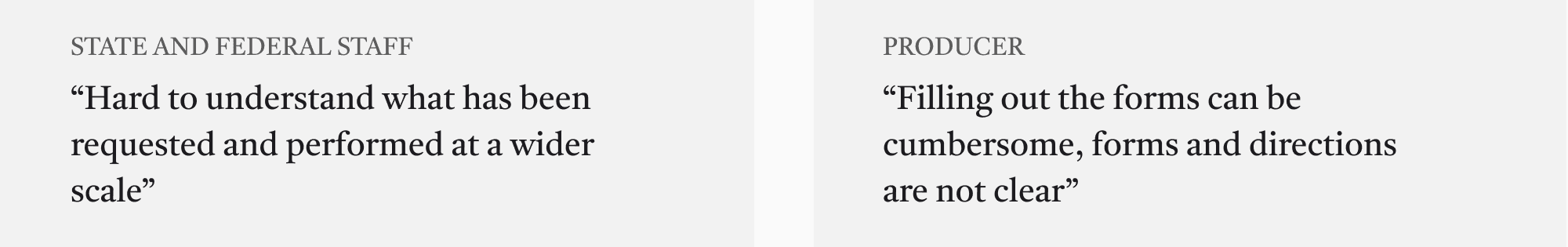
—- User pain points
—- Generalized flowchart

Initial goals

A/B testing and validation
Assumptions

User interviews with 4 county offices and state/fed staff
Selected version:
Staff and producer fills out together and staff approves. Field activity knowledge had to be confirmed by staff. Trade-off was that this design couldn’t save the producer a trip to the office.
Unselected version:
Producer can start the request on their own and wait for staff to review and request. However, staff may need additional information from producer, so the workflow process would take even longer.
Key findings through interviews

Updates on priorities
— Goals
— User flow

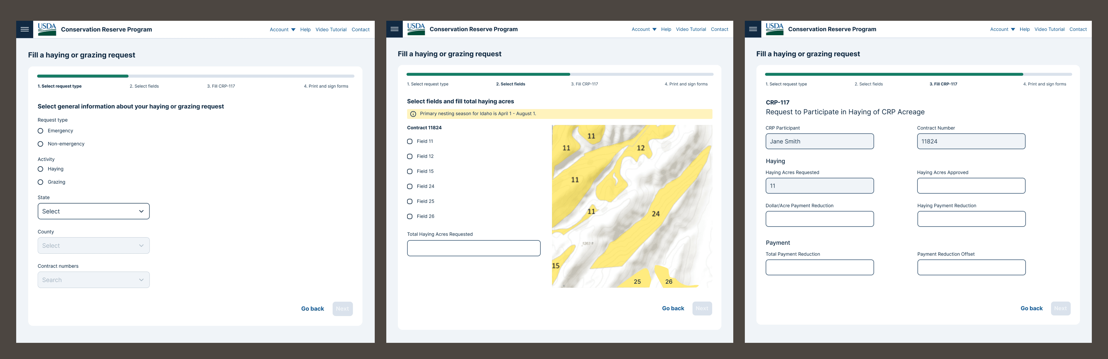
Prototype & delivery
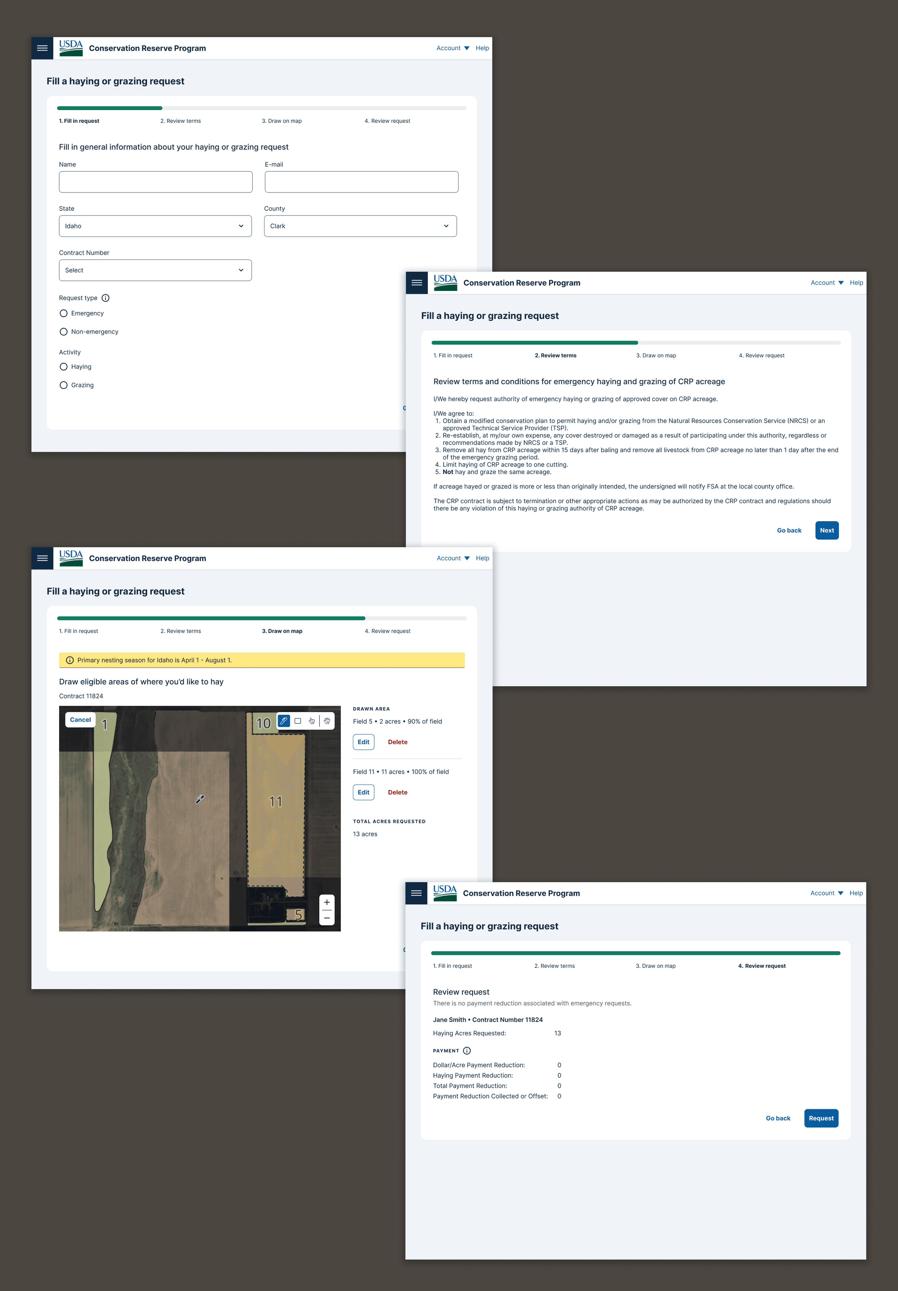
Outcome
